
Search a Columbus Street Directory by Address
Start a Columbus street-by-street search with the property record, not with an assumption about who occupies a building. In the Franklin County portion of Columbus, the Auditor turns a street number, direction, street name, and unit into a parcel result. That result can identify a current owner or tax identity and conveyance context. It cannot certify every person connected with the address. Columbus also extends into Fairfield and Delaware counties, so first confirm the parcel's county when an address is close to the city edge.
- Enter the verified Columbus address in the Franklin County Auditor search when the parcel is in Franklin County. Use the number, direction, street name without a suffix, and unit when available.
- Open the Columbus parcel result and retain the site address, parcel ID, legal description, and any conveyance reference. Compare the map placement before moving to another record system.
- Use the Columbus Auditor Parcel Viewer to inspect the selected parcel and the nearby street geometry. Its property link leads back to the property record.
- Search the Columbus Recorder by the recorded parties, document reference, or legal description. A deed is a land-record trail, not an all-household list.
- For a dated historic Columbus listing, consult a reverse or criss-cross directory through Columbus Metropolitan Library. Then verify that edition's address and year rather than blending it with a current property card.
When the question shifts from a whole street to confirming one named person, use the separate Columbus resident lookup workflow so the name can be checked across independent custodians.
Columbus Street Directory Search Fields
The Franklin County Auditor Property Search is built for a precise Columbus address route. Its instructions omit the street suffix, so a search uses the street name rather than adding Rd, Ave, or another suffix. The tool also supports an asterisk when spelling is uncertain or when a street-wide result is useful. The Auditor warns that an inexact query can return up to 500 results, which is a reason to add the number or direction before treating a hit as the right parcel.
| Field | Entry type | How it works on a Columbus street search |
|---|---|---|
| Street No | Text | Add the number to narrow a Columbus block or a specific site. |
| Direction | Dropdown | Use the Columbus directional prefix when the street has one. |
| Street Name Only | Text | Enter no suffix. The documented Columbus examples include *High and S *High. |
| Unit | Text | Use it where the Columbus portal exposes unit-level narrowing. |
| Parcel ID | Text | Accepts all or part of the Columbus parcel ID without dashes and supports wildcard patterns. |
The Auditor's owner-search screen shows the companion name route used after an address result identifies an owner. The captured form is pictured below. Its search behavior supports a Columbus by-street pass, but a result still needs a parcel-by-parcel review.
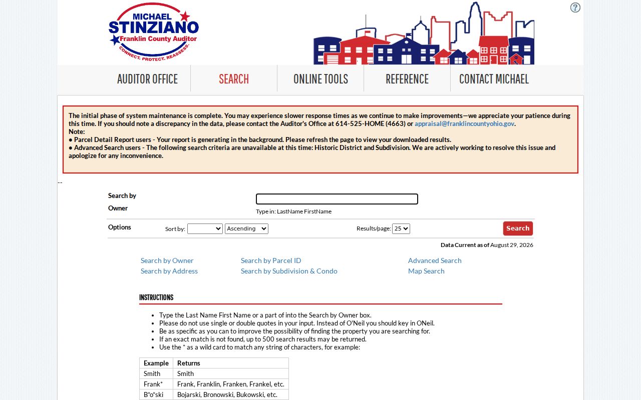
The owner form is useful for following a confirmed parcel identity, while the address form remains the better starting point for a street search.
Map a Columbus Street Segment
The Franklin County Auditor Parcel Viewer gives the Columbus street search a map-based check. After locating a parcel, use Map Identify for the property link. The Viewer also documents three selection modes: By Shape for a drawn area, By Value for a layer or field such as parcel ID or annexation, and By Spatial for a distance-based selection. A spatial search begins with a parcel, applies a buffer, and selects parcels fully inside or intersecting it.
The Columbus parcel set may be exported as CSV, and the map supplies layers, measurement, aerial or hybrid basemaps, draw and print tools. Those features show which parcels meet a street segment. They do not establish who is physically present at every address. A Columbus by-street search should use the map to choose records to inspect, then read each linked property result on its own terms.
The Parcel Viewer is shown here with the mapping interface used to identify a selected site.
The Viewer is especially helpful when a long Columbus street crosses a Columbus block, alley, commercial parcel, or municipal boundary that is not obvious from the street name alone.
Join Columbus Street Records by Parcel
A Columbus parcel ID is the stable bridge across the main Franklin County address systems. The Columbus Auditor supplies property identity, values, sales or conveyance context, tax district, and other inventory fields. The Treasurer Property Search accepts a name, street address, or parcel ID and supplies a tax trail. Its detail can include owner names, tax year, charges and payments, assessments, district, legal-description detail, and a Recorder instrument reference.
Compare those Columbus records rather than choosing whichever result seems closest. A mismatch may arise from a transfer date, tax-year lag, mailing-address difference, or search error. The property card and tax record do not decide title and do not create a complete occupant list. The Auditor's current systems upgrade can also make Property Search slow, incomplete, or unavailable, so the Columbus Treasurer, Parcel Viewer, Auditor counter, and Recorder are useful alternate channels.
The Treasurer's property-search page provides the separate name, street, and parcel entry route captured below.
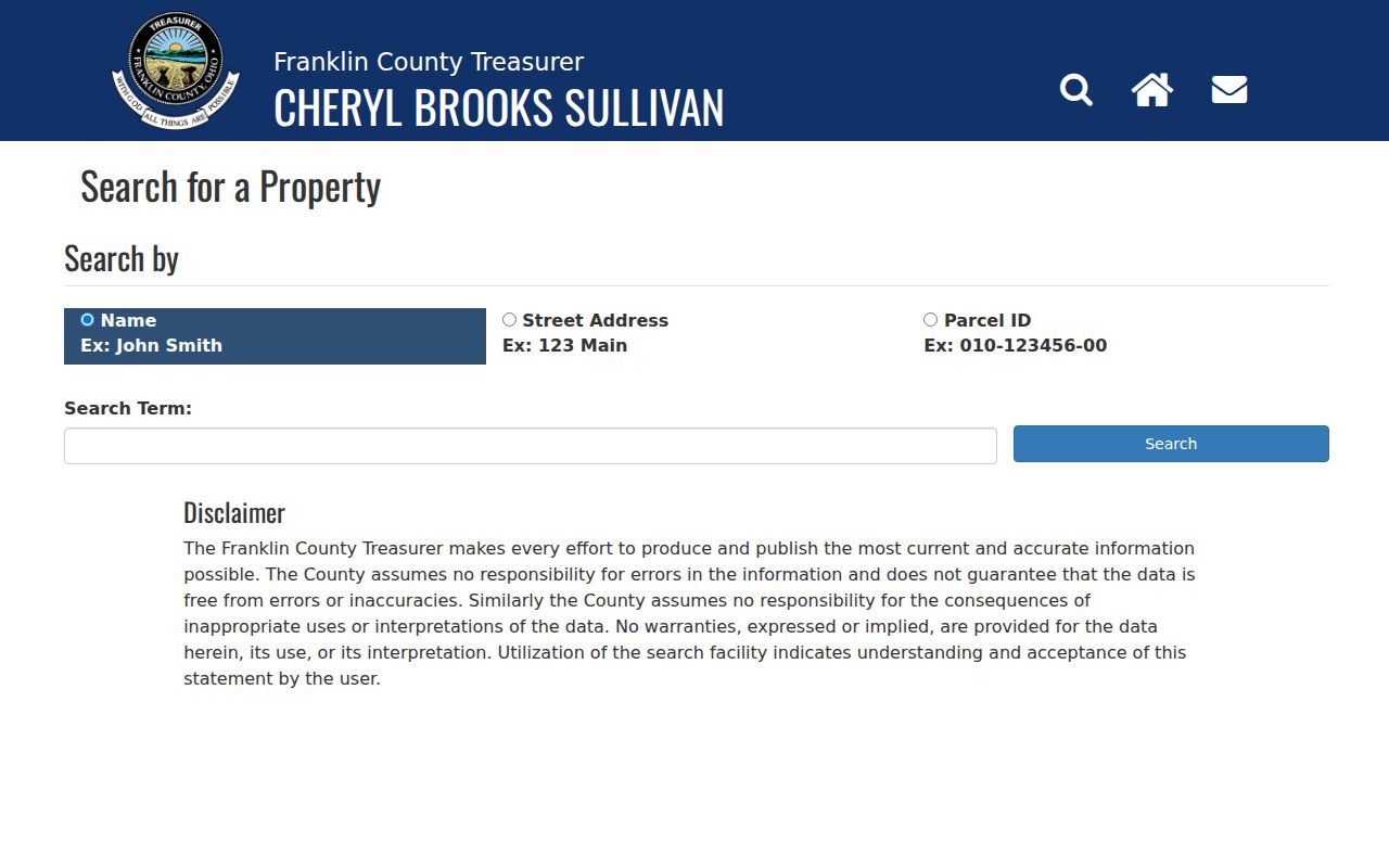
A Treasurer result can corroborate a Columbus parcel trail, but the Recorder instrument and the official custodian remain the source to verify when the records disagree.
Trace a Columbus Street Deed Chain
The Franklin County Recorder Advanced Search comes after the Columbus parcel record supplies a party name, instrument clue, or legal description. Its fields include party names, grantor, grantee, recorded-date range, document type and number, book, volume, page, OCR phrase, and subdivision or freeform legal description. Use the current conveyance to identify the grantee and grantor, then search the prior party as a grantee to move backward. Legal description and volume/page are often more durable than a Columbus street address.
The Columbus quick search has a meaningful scope choice. Index-only searching treats two or more words individually, while index-and-full-text OCR treats multiple words as a phrase. That difference can explain why the same words yield different results. Open the instrument and check its parties, date, legal description, and image before using it in a chain. The Recorder states that staff cannot perform title searches for users.
The Recorder Advanced Search displays the documented party, date, legal-description, and OCR controls.
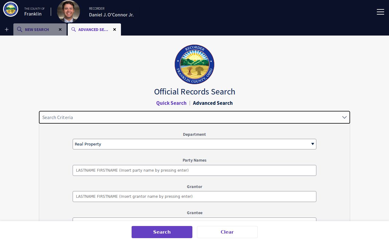
The range of search fields helps connect a verified Columbus parcel to a recorded instrument, but no single screen turns the document index into an address-wide residence list.
Columbus Street Deed Index Before 1914
Franklin County's older deed route is a useful Columbus records-history boundary. The Recorder's guide places the modern deed index from January 2, 1914, while its Deed Indexes 1804-1913 are a separate archive process. Select grantor or grantee, choose a period, enter initial letters, identify the handwritten-index page, and use the returned volume and page to retrieve the deed. That route can tie a historic Columbus property interest to an early county land book.
The 1879 fire destroyed some records, although the County says most were reconstructed. Treat that warning as part of the evidence, not as a reason to assume a missing Columbus link. The Recorder reported that 33,741 documents filed before 1997 were digitized in 2025, following 75,097 in 2024. More Columbus images online can assist research, but the statistics do not promise that every historic volume or page is searchable.
Note: Preserve the exact historic street form and legal description because an older deed may not use the current Columbus address.
Check Columbus Street Permit Records
Columbus Citizen Access adds municipal permit, code-enforcement, zoning, and planning records to a Columbus address search. Columbus instructs users to begin with one criterion, such as an address, parcel, or record number. For older material, remove an overly narrow date filter. A permit can document a construction or alteration date, and a code item may provide a public case or responsible-party clue. Neither supplies a complete list of people at the address.
When the online Columbus result does not expose a needed nonexempt record, Columbus Building and Zoning Services provides a counter and public-records route. Under the Ohio Public Records Act, public offices must promptly prepare records for inspection and make copies available within a reasonable period, subject to exemptions and actual copying or delivery costs. Ask for an existing record with a focused description rather than a custom analysis.
Columbus Building and Zoning online services shows the public portal path used for these address-linked records.
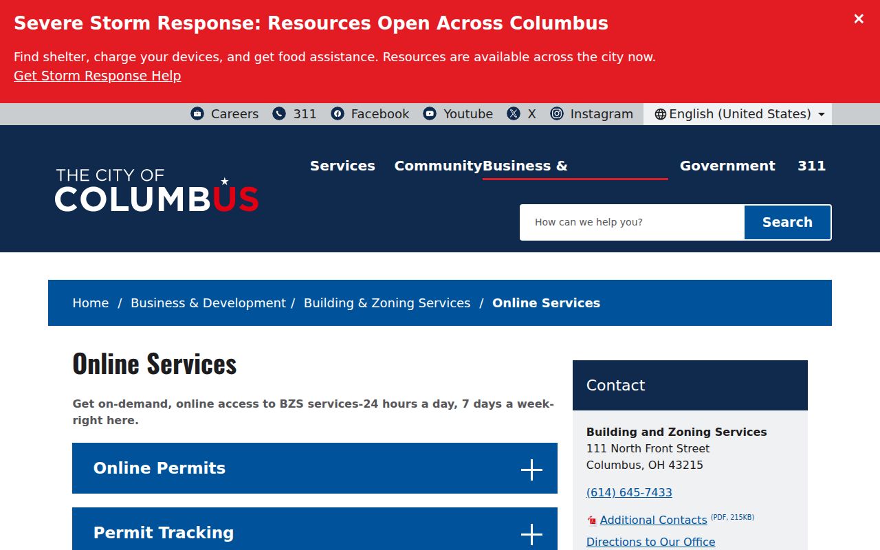
City permit and code results are a separate Columbus street record line, so their dates and scope should be compared with, not substituted for, parcel and deed evidence.
Read a Columbus Street in Reverse
For a past Columbus address-year listing, the Columbus Metropolitan Library house-history guide points to city directories and reverse directories alongside deeds, maps, and permits. A Columbus reverse or criss-cross directory is arranged by address rather than alphabetically. It can connect an address with a listed person or business for the edition year, while the alphabetical side of that volume may add the entry details used by the publisher.
Use a specific Columbus edition and retain its publication year. A historical directory listing should not be merged automatically with a later owner record. The deeper collection history and access options belong on the Columbus city directory page; here, the reverse section serves as one carefully dated street-by-street clue.
- Parcel
- A defined unit of land tracked by the county and linked to a parcel ID.
- Situs address
- The physical site address used to locate property, distinct from a tax mailing address.
- Plat
- A recorded map that lays out lots, streets, and related land divisions.
- Criss-cross directory
- A historical address-first directory section that can identify a listing for one publication year.
Columbus Street Addresses Cross Boundaries
Columbus records geography is not limited to Franklin County. The Columbus corporate-boundary GIS layer draws from Franklin, Fairfield, and Delaware County parcel layers and says it is not a legal boundary record. A Columbus mailing label may therefore require a different county auditor, recorder, court, or elections path. Columbus annexation can also affect tax, election, and service context without changing the familiar street name.
Columbus Building and Zoning Services GIS assigns certified Columbus addresses under City Code Chapter 907 and maintains regional address and street-name records. Preserve the historic spelling and number when a search fails. One documented example is the 1956 change from Lewis Avenue to Louis Avenue between Eighteenth and Nineteenth avenues. The Columbus addressing office is the escalation point for a questionable certified address, while county recorders hold legal boundary records.
Columbus Regional Address Points exposes municipal city, USPS city, ZIP, parcel, status, and address-component attributes.
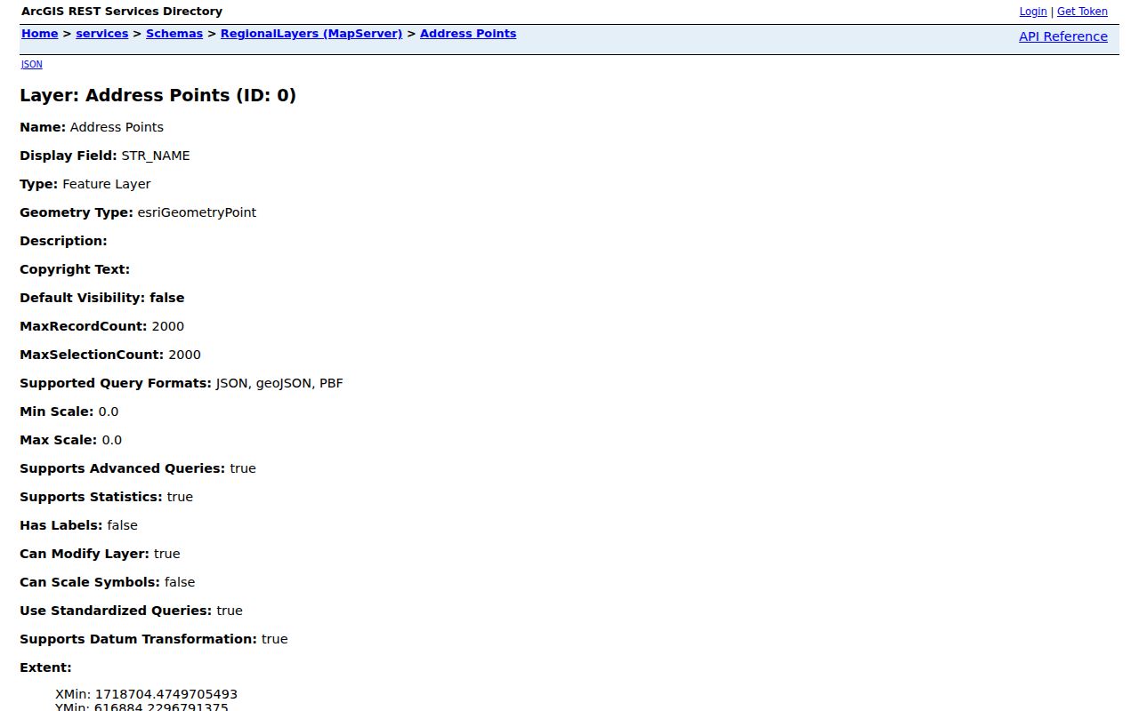
Those address-point attributes can orient a Columbus street search, but a legal boundary question still belongs with the appropriate county recorder.
Columbus Street Directory Record Coverage
Columbus address-keyed sources overlap, but they should not be treated as duplicates. The best Columbus route uses the record set that answers the question at hand, retains the parcel or legal-description bridge, and uses the listed offline channel when an online result is unavailable. The Franklin County Recorder is at 373 S. High St., 18th Floor; the Auditor and Treasurer counters are in the same building on the 21st and 17th floors respectively.
| Columbus address record | Custodian | Useful evidence | Online and fallback access |
|---|---|---|---|
| Property inventory | Franklin County Auditor | Columbus parcel ID, site address, owner or tax identity, appraisal, conveyance context | Columbus address, owner, parcel, subdivision, map, and advanced search; public counter or phone fallback |
| Tax bill and history | Franklin County Treasurer | Columbus tax-year charges, payments, district, and legal-description or Recorder reference | Name, Columbus street, or parcel search; Columbus Treasurer counter |
| Recorded instruments | Franklin County Recorder | Columbus parties, document type and date, instrument number, legal description, and available images | Free quick or advanced search; 1804-1913 archive route; Columbus Recorder counter |
| Parcel geography | Auditor GIS | Columbus parcel placement, adjoining parcels, map layers, and selected results | Columbus Parcel Viewer identify, buffer, and export tools |
| Permit or code history | Columbus Building and Zoning Services | Columbus address or parcel-linked record number, type, date, and public detail | Columbus Citizen Access, BZS counter, or focused public-records request |
| Historic reverse listing | Columbus Metropolitan Library | Columbus address-to-listed person or business in a specific publication year | Columbus house-history guide and library collections |
Note: The Auditor's active systems upgrade makes the Parcel Viewer, Treasurer, Recorder, counter, and documented request routes important backups for Columbus searches.
Limits of a Columbus Street Directory
A Columbus street directory can connect public Columbus property, land, permit, and dated directory records. It cannot turn those sources into a full resident list. A property card reflects an ownership or tax relationship. A parcel map reflects boundaries. A voter lookup is designed for an individual's registration and is not a street roster. Protected addresses, confidential case material, private personal information, utility-customer data, and motor-vehicle address information remain outside this Columbus address method.
Ohio's Safe at Home Address Confidentiality Program gives qualified participants a designated address, and agencies must handle their records as directed by law. Election records also exclude protected identity and contact information. A no-match, an inactive record, or an older Columbus address mismatch is not proof that a person never lived at a location. Confirm nonexempt Columbus public records with their custodian and respect the limits around protected information.
Lawful use. Use Columbus street and address records for lawful personal research, and never use a record to stalk, harass, intimidate, or harm another person.